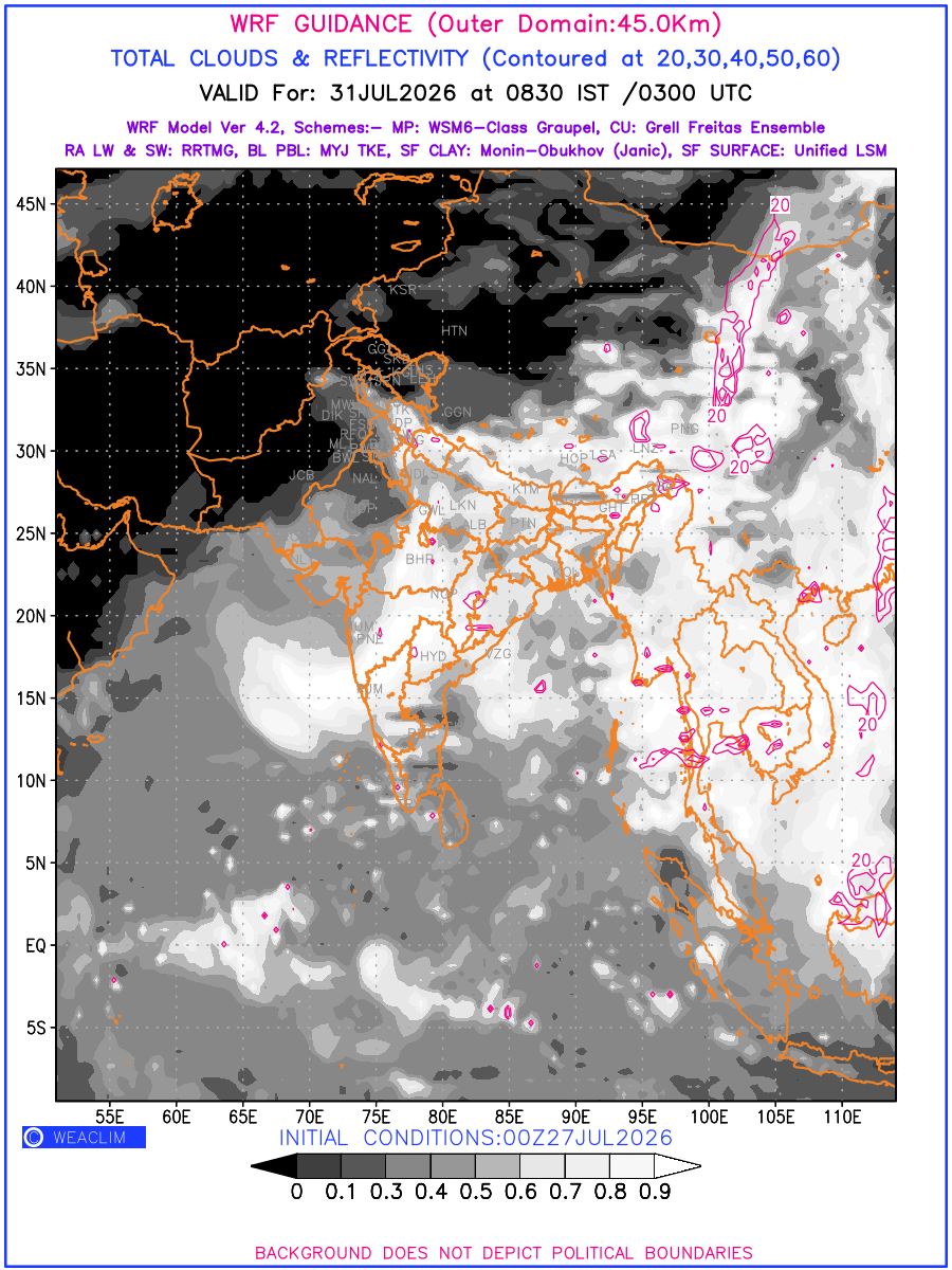
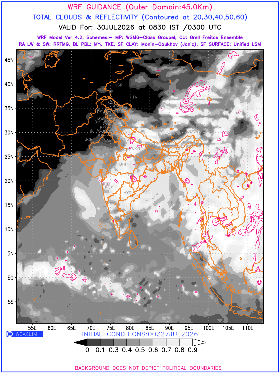
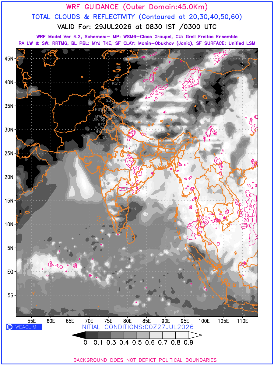
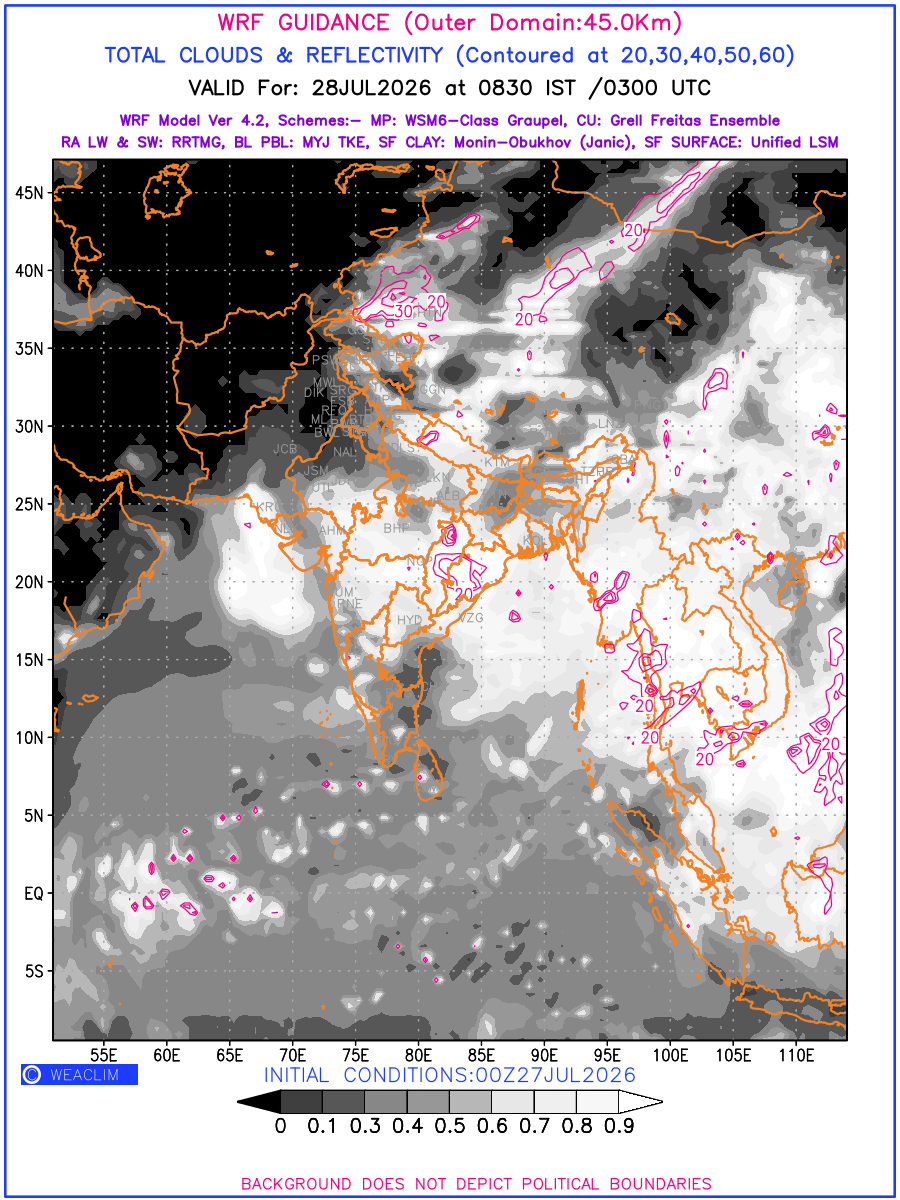
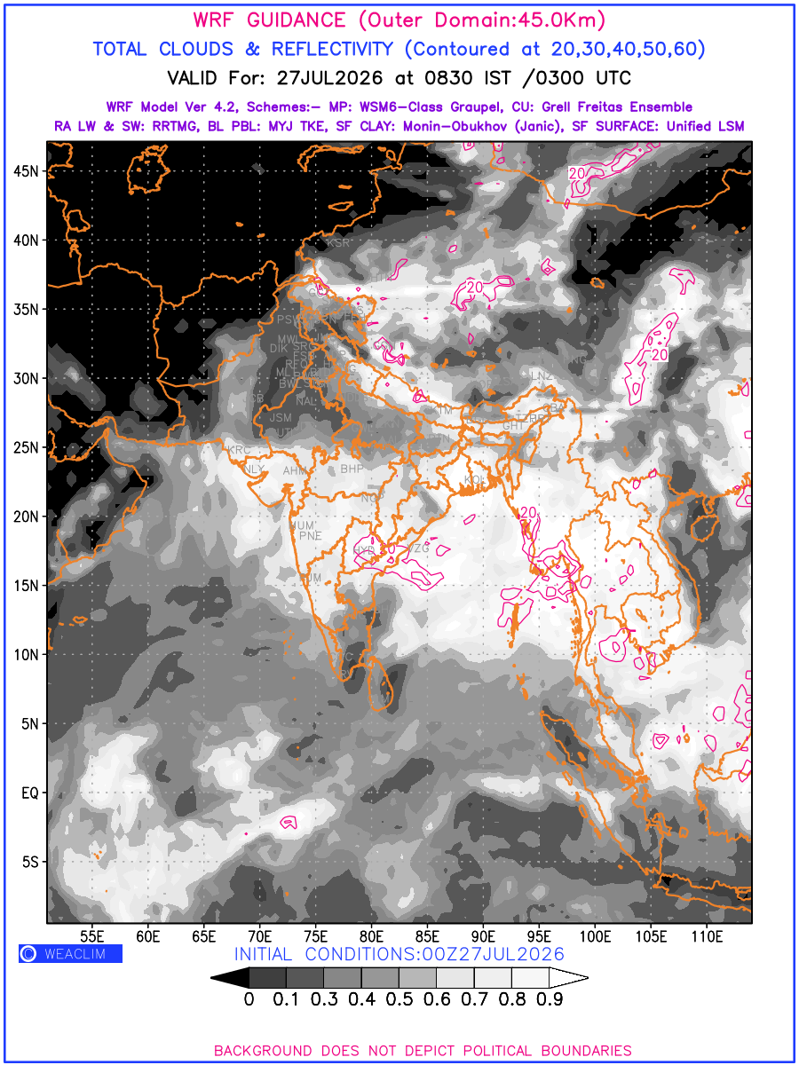
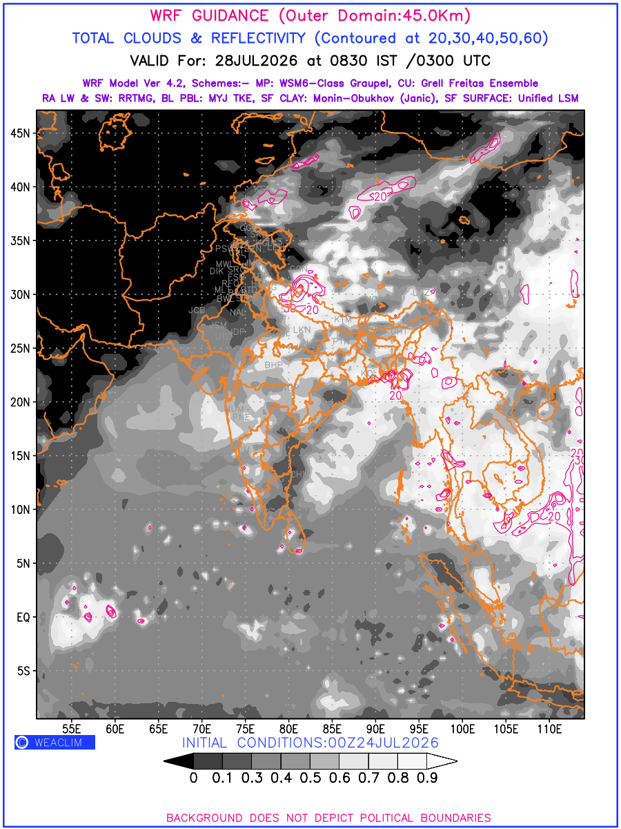
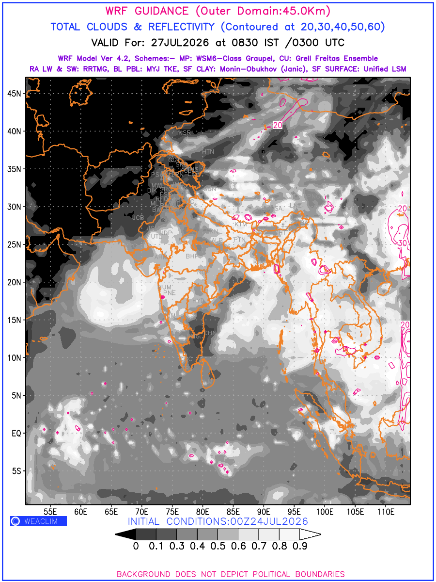
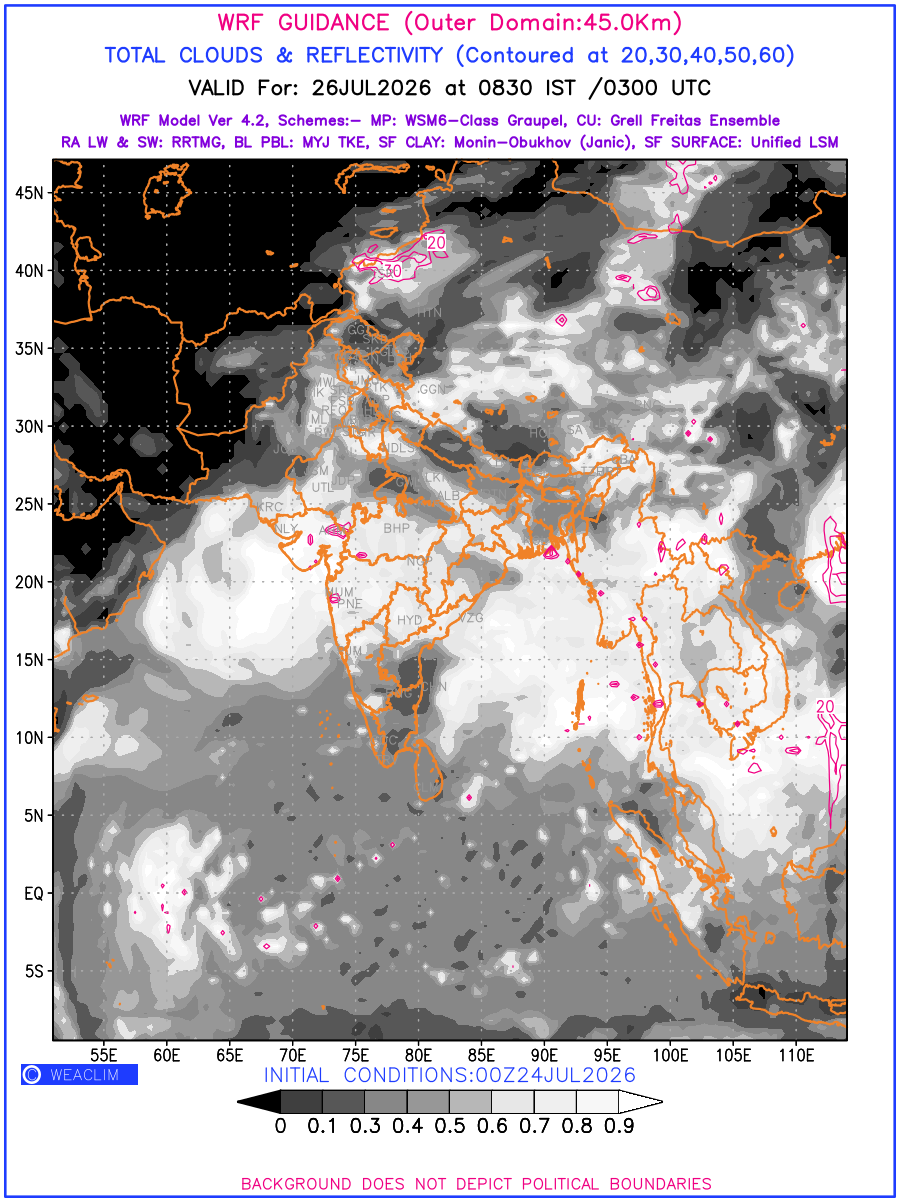
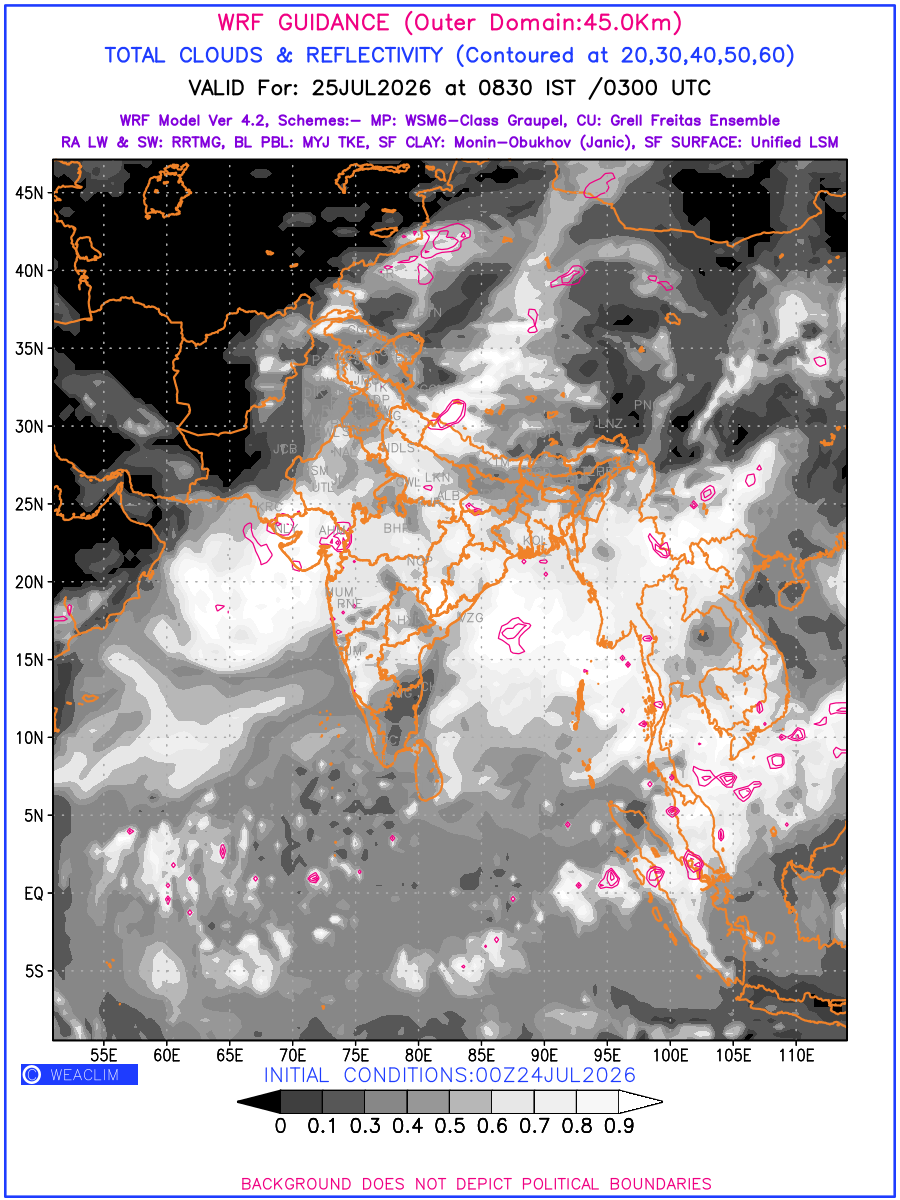
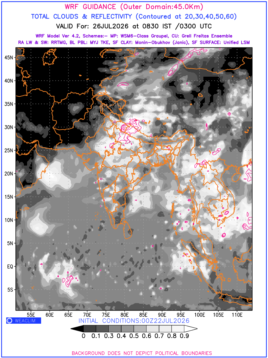
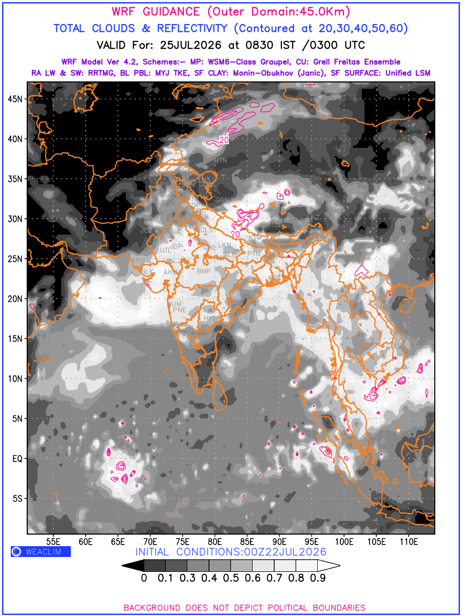
Cloud forecast at the 24 th hour generated using WRF Ver 4.2 at a resolution of 45 Km for India is the predicted pattern of clouds and percentage of the sky covered by them akin to an InfraRed Imagery given by the meteorological satellites. Convective clouds are formed by the vertical movement of air in the atmosphere and are associated with thunderstorms and other types of severe weather like intense rainfall, strong gusty winds, low clouds etc. The charts use shading from black to white with whiter shade depicting more intensity of convection on a scale ranging between 0 to 1. Also shown is the Maximum Reflectivity that takes the maximum reflectivity from each elevation angle of the Doppler Weather Radar and meshes it into one image. Advantage of this type of image is the ability to quickly assess the intensity of storms. Predicted pattern of Total Clouds and percentage of the sky covered by them is shown here along with Maximum Reflectivity over the Indian Region and its neighbourhood for the next four days.
Showing 1–12 of 45 results